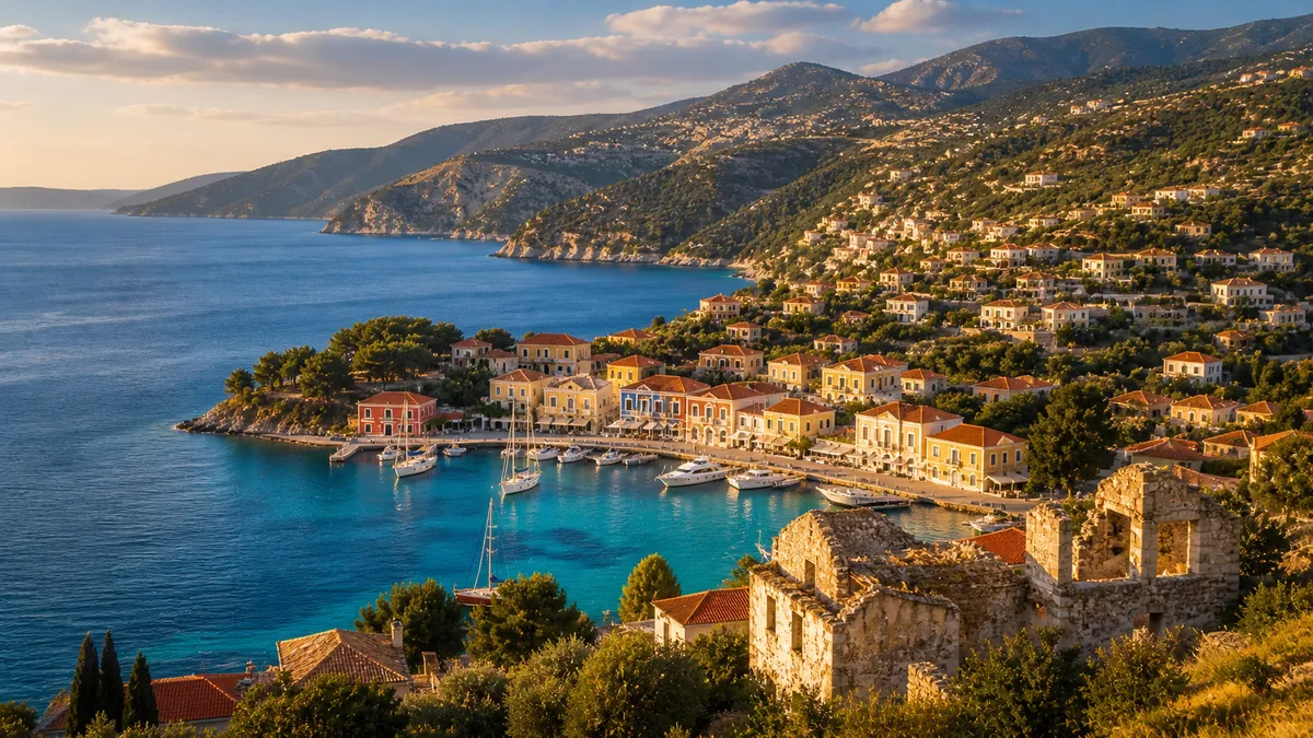
First-time visitors to Kefalonia sometimes notice something unusual: the island's towns feel newer than they should. The architecture is Greek in spirit — white plaster, terracotta tiles, campaniles above a harbour — yet it lacks the accumulated patina of centuries you find in the old towns of Rhodes or Nafplio. Streets are unusually wide. Buildings rarely predate the 1950s. The proportions feel almost planned, as if someone started with a blank sheet.
There is a reason for this. On August 12, 1953, an earthquake of magnitude 7.2 destroyed almost every building on the island. What you see when you visit Kefalonia today is the rebuilt island — a place that had to reconstruct itself almost entirely from nothing, in the middle of a Greek summer, with the world watching and winter approaching.
Understanding what happened that August changes how you see everything.
The Days Before: Foreshocks and Fear
The mainshock did not arrive without warning. Three days earlier, on the morning of August 9, a magnitude 6.4 earthquake struck the western approaches to the island. It was strong enough to shake buildings, crack walls, and alarm the population — but in a region where minor tremors are routine, people hoped the earth had released what it needed to release.
It hadn't. On August 11, a second, larger foreshock — magnitude 6.8 — arrived, this time causing widespread structural damage and genuine panic. Families began sleeping outdoors in their courtyards and olive groves. Some made for their boats in the harbour. Older residents, drawing on folk knowledge passed down through a region where the ground periodically moves, sensed that this was not over.
At 11:24 in the morning on August 12, 1953, it wasn't.
August 12: The Ground Moves
The epicentre was located in the waters directly west of Kefalonia, at 38.18°N, 20.94°E. The magnitude reached 7.2 — one of the most powerful earthquakes ever recorded in European history. The shaking lasted for more than a minute. On a seismograph that looks like a thin line of numbers; in a stone building it is a catastrophe with no end.
In Argostoli, the island's capital, the main harbour quay collapsed into the sea. Buildings that had stood since the Venetian occupation — some of them for three hundred years — came down in under sixty seconds. Those that survived the initial shaking were then consumed by fires, ignited by overturned braziers and ruptured cooking stoves, that burned for three days. The town's water supply had been severed in the quake. There was nothing to fight the fire with. Argostoli was reduced, methodically, to ash and rubble.
Across the island, more than 27,659 buildings were destroyed or rendered permanently uninhabitable. The force was so extreme that Kefalonia itself shifted — the island's bedrock was thrust upward by as much as 70 centimetres. For years afterwards, the evidence was written into the coastal landscape: a pale horizontal watermark on rocks and cliffs, precisely tracing where the sea had once met the stone before the earthquake lifted the land.
Village by Village: What Was Lost
The destruction was not quite uniform, but it was nearly total. Town by town, the same story unfolded.
Argostoli burned for three days. The old capital — with its Venetian-era palaces, neoclassical mansions, and covered market — ceased to exist. The rebuilt Argostoli occupies the same geography but was laid out afresh: wider streets, lower buildings, modern proportions.
Sami, the main eastern ferry port, was completely destroyed. It was rebuilt with characteristic efficiency: a grid of wide streets, single-storey prefabricated houses, plain and functional infrastructure. The rebuilt Sami is immediately legible as a product of post-disaster planning rather than centuries of organic growth.
Assos, the village on the northwest peninsula beneath its Venetian fortress, was obliterated. Not a single building survived intact. The village visible today was constructed entirely after 1953 — but with such care and sensitivity to its pre-earthquake character that it has become one of the most admired villages in Greece. The Venetian castle on the headland, built from solid stone on solid rock, survived without significant damage.
Lixouri, the second city on the Paliki peninsula, was catastrophically damaged and subsequently rebuilt to the same planning principles as the rest of the island.
Kourkoumelata stands apart from the story of institutional reconstruction. The Kefalonian shipowner Georgios Vergotis funded the rebuilding of this village personally, at his own expense, commissioning a unified architectural style that remains visible today. It is one of the most unusual post-earthquake villages in Greece — planned like an estate, maintained like a monument.
The Human Cost
In Kefalonia alone, 455 people died. A further 2,412 were injured. Twenty-one were never found. The total across the Ionian Islands — Zakynthos and Ithaca also suffered severely — was higher. But the figures do not fully capture the weight of the event: tens of thousands were left homeless in the middle of summer, with autumn approaching and almost no intact shelter anywhere on the island.
In the weeks and months that followed, people left. Not a trickle, but a flood. Kefalonians emigrated to Melbourne, Toronto, New York, London, Johannesburg — entire families, extended networks, the most mobile members of a broken community. The Kefalonian diaspora, which already had roots in earlier waves of emigration, grew enormously after 1953. Today the descendants of earthquake survivors can be found across Australia, North America, South Africa and the UK, many of them maintaining deep emotional connections to an island their parents or grandparents fled.
The Arogi: Rebuilding from Zero
The reconstruction programme was called the arogi — the Greek word for assistance or relief — and it was one of the largest post-disaster rebuilding efforts in European history at the time.
International aid arrived quickly and from unexpected quarters. The United States, United Kingdom, Italy, and Israel all contributed materials, engineering expertise and personnel. One historical footnote still noted in Greek-Israeli relations: the relief operation at Kefalonia was the first humanitarian mission ever undertaken by the Israeli Navy.
The Greek Ministry of Reconstruction designed 25 standardised building types — the arogi buildings — that could be constructed quickly, cost-effectively, and seismically soundly across the island. Low to the ground, simply built, and utterly unlike the vernacular architecture they replaced, these structures provided immediate shelter and became the foundation of the new settlements. Many are still standing, recognisable to anyone who knows what they are looking at.
The goal was not to restore what had been lost. The goal was to make the island liveable again before winter. In that, it succeeded.
What Visitors See Today
Argostoli today is a mid-century Greek city: wide, low-rise, practical. The wide streets — designed so that collapsing buildings would leave escape routes clear — are its most distinctive feature. Some structures from before 1953 survive. The Drapano bridge and its associated cemetery were largely spared. The Monastery of Agios Andreas on the Paliki peninsula was damaged but not destroyed; restoration work later revealed 16th-century frescoes beneath layers of later plaster, an accidental archaeology. The Korgialenios History and Folklore Museum in Argostoli preserves what it can of pre-earthquake material culture, though many historic photographs and documents were lost in the disaster itself.
For the most complete encounter with what Kefalonia looked like before 1953, you need to go north.
Fiskardo: The Island Before
In the far north of Kefalonia, the small village of Fiskardo was spared. The combination of its geology — sitting on bedrock that absorbed less of the wave energy — and the solid construction of its Venetian-era buildings meant that when August 12 ended, Fiskardo was still standing.
The result is without parallel on the island. Fiskardo is the only place where you can see Kefalonian architecture as it actually was before 1953: the tall Venetian houses with their arched doorways and ochre plasterwork, the irregular medieval street pattern, the harbourside buildings that have stood for three centuries. When you walk through Fiskardo, you are walking through what Argostoli looked like, what Sami looked like, what dozens of villages across the island looked like before the earthquake.
You can learn more in our guide to Fiskardo, Assos and Argostoli.
The Fault That Never Rests
The 1953 earthquake was not a freak event — it was the most violent expression of a tectonic reality that has shaped this part of the Mediterranean for millions of years. Kefalonia sits on the Cephalonia Transform Fault, a major plate boundary running along the island's western edge where the African Plate presses against the Eurasian. It is one of the most seismically active zones in all of Europe.
Smaller earthquakes happen frequently and are barely felt. Larger ones come periodically. In January 2014, a series of earthquakes — the largest magnitude 6.1 — struck the Paliki peninsula. Buildings were damaged and some residents were temporarily displaced. But there were no fatalities. The seismic engineering standards introduced after 1953 had done their job.
For those interested in the deeper geology, the Kefalonia Geopark documents the island's tectonic story and organises guided geological routes.
Memory and Culture
On August 12 each year, Kefalonia marks the anniversary with a formal memorial ceremony. It is not distant history here. For island families, 1953 is living memory — grandparents who were children in the rubble, parents who grew up hearing the stories, a diaspora scattered across the world partly because of what happened that morning.
The earthquake entered world literature through Louis de Bernières' novel Captain Corelli's Mandolin (1994), which culminates in the earthquake and its aftermath. The 2001 film, shot partly on location in Kefalonia with Nicolas Cage and Penélope Cruz, brought a further wave of visitors who came specifically to see the landscape they had read about or watched on screen.
If you visit in May or another shoulder-season month, the Korgialenios Museum is worth a morning of your time.
A Different Kind of Old
Kefalonia is an ancient place — inhabited for millennia, contested by Venetians and Ottomans, home to one of Greece's richest intellectual and musical traditions. The earthquake did not erase that history. It erased its physical expression.
What stands today is an island that rebuilt itself in less than a decade, absorbed its grief partly through emigration and partly through sheer determination, and went on to become one of the most extraordinary destinations in Greece. The rebuilt towns are not fake — they are simply younger than they look, carrying the memory of what stood before them in every wide street and low roofline.
That is what the streets are saying. And if you want to know more about the island's history before you arrive — or while you are here — ask Memas, our AI concierge, who will point you in the right direction.
For the scientific and historical record, see the 1953 Ionian earthquake on Wikipedia. For geological routes and tectonic heritage, visit Kefalonia Geopark.
Planning your trip to Kefalonia? Ask Memas — our AI island guide →